As Indians, we love to travel whether it’s backpacking across Europe, exploring the rich cultures of Southeast Asia, or visiting family and friends in the Middle East or North America. But if it’s your first time traveling internationally, you might naturally rely on Google Maps or Apple Maps to get around. After all, they’re the go-to apps in India for directions and public transport.
However, when you’re navigating unfamiliar countries especially those with complex transit systems or language barriers these mainstream apps may not always be the most reliable. Some countries restrict map data sharing, others have local apps that are far more precise, and many global destinations offer public transport options that simply aren’t listed on Google or Apple Maps.
That’s where this list comes in. These alternative travel apps can help you navigate foreign cities more efficiently, especially if you’re planning to use public transport or multi-country travel routes.
Here are the best alternatives to Google Maps and Apple Maps that Indian travelers should download before heading abroad:
1. Citymapper – For the Urban Explorer
Best for: City travel in Europe, Asia, and selected U.S. cities
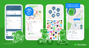
Citymapper stands out for its ability to map out the most efficient routes in major cities. Unlike Apple and Google Maps, Citymapper gives you detailed directions not just for walking or driving but for buses, subways, trams, ferries, bicycles, scooters, and even ride-sharing.
-
Covers 72 European cities and top Asian destinations like Tokyo, Seoul, and Hong Kong
-
Only supports 28 cities in the U.S., but all major metros are included
-
Offers real-time departure times and service alerts
-
Ideal for first-time travelers in unfamiliar urban areas
2. Moovit – Your Global Public Transport Companion
Best for: Public transit in over 100 countries, especially in Asia, Africa, and South America
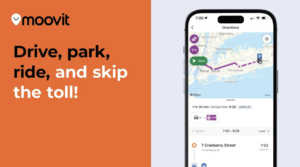
Moovit is the app you want if you’re heading to countries where transit infrastructure exists but may not be visible on global apps like Google Maps. It supports over 3,400 cities in 112 countries, many of them in regions overlooked by other apps.
-
Especially helpful in Eastern Europe, Latin America, Africa, and large parts of Asia
-
Allows offline downloads of city maps great for saving data abroad
-
Gives real-time updates on buses, trains, and subways
-
Perfect for navigating smaller cities or rural transport hubs
3. Naver Map – The Must-Have Map for South Korea
Best for: Anyone visiting South Korea

In South Korea, both Google Maps and Apple Maps are restricted due to local data privacy laws. This makes Naver Map the top navigation tool in the country.
-
Offers accurate real-time directions for public transport
-
Lists nearby restaurants, cafes, ATMs, and businesses
-
Available in English, so non-Korean speakers can use it with ease
-
Works great for navigating Seoul’s complex metro system
4. Rome2Rio – Plan Cross-Border Travel Like a Pro
Best for: Multi-country journeys and travel planning across continents

If you’re planning to backpack across Europe or travel between countries in Asia, Rome2Rio is your best bet. It shows you all travel options between any two global destinations—whether by bus, train, flight, ferry, or car.
-
Great for planning long-distance routes
-
Includes estimated travel times and costs
-
Shows different combinations of transport (e.g., train + ferry + bus)
-
An essential app for Euro-trippers and long-haul planners
5. Transit – For Simple, Instant Directions
Best for: Tourists in North America, France, and select global cities

If you want a super clean and simple interface for local transport, Transit is a go-to. It immediately shows nearby public transport lines and live departure times with zero setup.
-
Uses color-coded bar charts to display route options
-
Great for users who want easy-to-understand instructions
-
Supports cities in U.S., Canada, France, and some top destinations like Australia, UK, and New Zealand
-
Ideal for day-to-day city commuting during your trip
Final Thoughts
Traveling internationally can be thrilling but getting lost in a new city isn’t. Don’t rely solely on Google Maps or Apple Maps when you head abroad. Depending on where you’re going, these local and global apps can offer better accuracy, more transit options, and offline functionality things that matter most when you’re traveling in unfamiliar territory.
So, before you zip up your suitcase, download these smart alternatives and travel with confidence.